
Climbing Gunung Datuk in Negeri Sembilan, Malaysia

Climbing Gunung Datuk in Negeri Sembilan, Malaysia
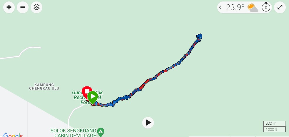
Climbing Gunung Datuk takes roughly 4h30 (including 20 to 30min at the top). The mountain sits at 1,200m above sea level in Negeri Sembilan and is about 1h30 drive from Kuala Lumpur and can be done in a day.
This hike is a great training for climbing Mt Kinabalu as it’s steep and helps build stamina.
There is a car park by the entrance of the trail - you can also park along the roadside leading to the parking if it’s full. You will quite quickly see others doing it as you drive along the dead-end street leading to it.
You do not require a permit to attempt this hike. However, there is a checkpoint at the entrance of the trail where you will have to register and pay RM5 for Malaysians, and since November 2022, RM20 for non-citizens. (*Rant on*: they refused work permit for expats and we were charged RM20 too - they do not control ID ... so it's more the case of a "white men" tax. We climbed this summit paying RM5 many times, so it was quite infuriating. No improvements were made to facilities or trail. *Rant off*). It’s also because the trail entrance is closing at 12h. They don’t allow hikers after that. All climbers are expected to be out no later than 5pm.
 The trail is exceptionally steep at some sections and ropes have been set up almost the entire way. It’s not an easy hike by any means. You should expect about 2h to go up but almost as much to go down. Going down is tricky as you will probably need to walk backward on the steepest portion hanging on to the rope to somewhat abseil down.
The top is first a flat rock section and the peak boulder can be reached by a series of ladders. It’s a very nice place to find a spot and have breakfast. The summit sits in the clouds and the view can be disappointing on a cloudy day. We were told the clouds usually lift at about 11am. And we hiked it another clear day a few months later, and indeed the view is stunning!
It’s a beautiful hike, it’s long only because it’s steep and slow, but in terms of kilometers the trail is very reasonable, barely 6.8km return. It’s a great outing day with friends that could be combined with waterfalls nearby or booking a nearby guesthouse for a barbecue and stay the week end. We combined it with once a week-end in Melacca ( you already drove half the way afterall ) and once with Port Dickson.
You can also download the .GPX file to be imported into Google Maps or your Garmin watch as a Course.
This way you can save the path offline and use it during your walk.
Happy Trekking !


